
By Jan Mulroy
In his assessment of the Ouleout Creek at right, Ian Gedicks gives us an overall action plan: “The sites of erosion estimated to load the greatest amount of nutrients and sediment should be targeted for future stream restoration projects.”
Outreach for these targeted sites will come from Delaware County Soil and Water Conservation District (DCSWCD).
They will work with the landowner, assessing and applying best management practices (BMPs) to remedy streambank erosion, all the while helping the landowner connect with applicable funding opportunities. DCSWCD works diligently with farmers and private landowners to develop plans and designs for stream stabilization and restoration projects while being mindful of cost effectiveness as well as minimizing farmer/landowner out-of-pocket costs.
For some perspective, the Ouleout Creek Watershed drainage basin is 106 square miles, representing just 1.7% of New York’s portion of the Susquehanna River Watershed (6,250 square miles). Looking at total phosphorus (TP) in 2020, New York delivered 577,824 lbs. from all major sectors: Agriculture – Wastewater, Developed, Natural, Septic – averaging 92.45 lbs./yr./square mile.
In the 20-mile assessed section of the creek, from the amount of calculated eroded streambank sediment, the estimated TP at 3,900lbs./yr., would deliver on average, 195 lbs./yr./per assessed streambank mile. Ian Gedicks also wrote: “Several sites of erosion accounted for a disproportionate amount of the eroded material along the Ouleout”.
Last December 18th, the Ouleout Creek sustained a rain event where two inches of rain fell in less than 24 hours. The photo below was taken from West Street in the Village of Franklin. Ian said of this photo: “High flow events are when the majority of erosion and deposition occur in a stream channel.”
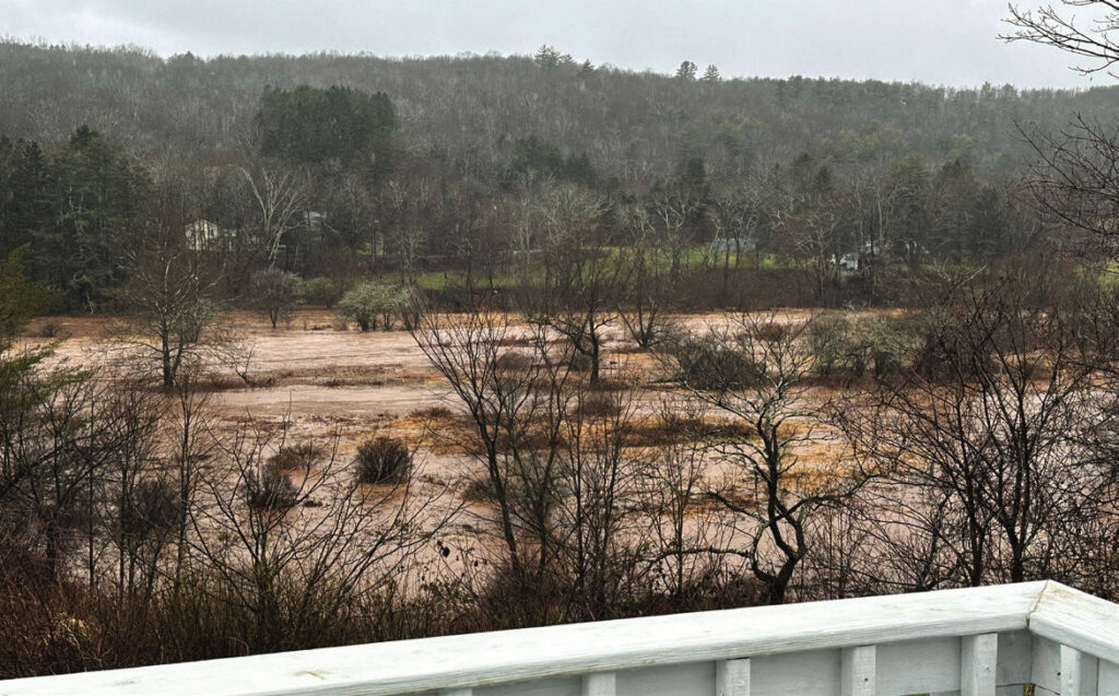
The Ouleout in 2023 flood as seen from West Street – Photo by Mary Burns
The Ouleout Creek Assessment gave us numbers to realize the creek’s contribution to the Chesapeake Bay Program TMDL. It also gave us targets to mitigate those numbers.
Why do we care? Streambank erosion and high flow events in the creek have local consequences as well.
For example, the dissolved nutrients from eroded streambank sediment can contribute to harmful algal blooms or HABs. In 2023, East Sidney Lake reported HABs to New York State Department of Environmental Conservation twice in the month of July and the beach was ultimately closed for swimming per NYS Department of Health protocols.Closing the beach to day visitors and campers alike can affect Franklin’s local economy by way of purchases at local stores, restaurants, the gas station and convenience store, Farmers Market and farm stands, to name a few.
It might be advisable to learn more from DCSWCD and see what they have to offer.